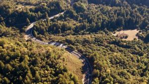
Highways connect us, but also divide the land and create barriers to safe passage for both wildlife and people. In the Santa Cruz Mountains, California state route 17 (Highway 17) fragments thousands of acres of open space, limiting the ability of wildlife to find food, mates and habitat, as well as preventing the completion of several regional trail systems. Together with private and public partners, neighbors and District constituents, Midpen is exploring the feasibility of developing two independent road crossings - a wildlife undercrossing and recreational trail overcrossing - to link over 30,000 acres of protected public lands.
The project also includes directional fencing that will help animals safely find their way to the wildlife crossing and a number of regional trail connections that will link the following Santa Clara County parks and Midpen open space preserves together across Highway 17: Sanborn County Park, El Sereno Preserve, Lexington Reservoir County Park, St. Joseph's Hill Preserve, Sierra Azul Preserve and Almaden Quicksilver County Park.


Goals
- Link over 30,000 acres of habitat and protected public lands on both sides of Highway 17, including Midpen preserves (El Sereno, St Joseph's Hill and Sierra Azul) and Santa Clara County Parks (Lexington, Sanborn and Almaden Quicksilver)
- Improve motorist safety by reducing the potential for collisions with wildlife
- Maintain healthy wildlife populations
- Provide two structures - one for wildlife and one for recreational trail users - that support safe movement across Highway 17
- Connect over 50 miles of existing regional trails, including Bay Area Ridge Trail, Juan Bautista De Anza National Historic Trail and Los Gatos Creek Trail
- Develop a Mitigation Credit Agreement (MCA) to offset potential ecological impacts from construction with project benefits like habitat connectivity
Project components, colors, materials, etc. will be finalized during the design phase.)

Stay informed!

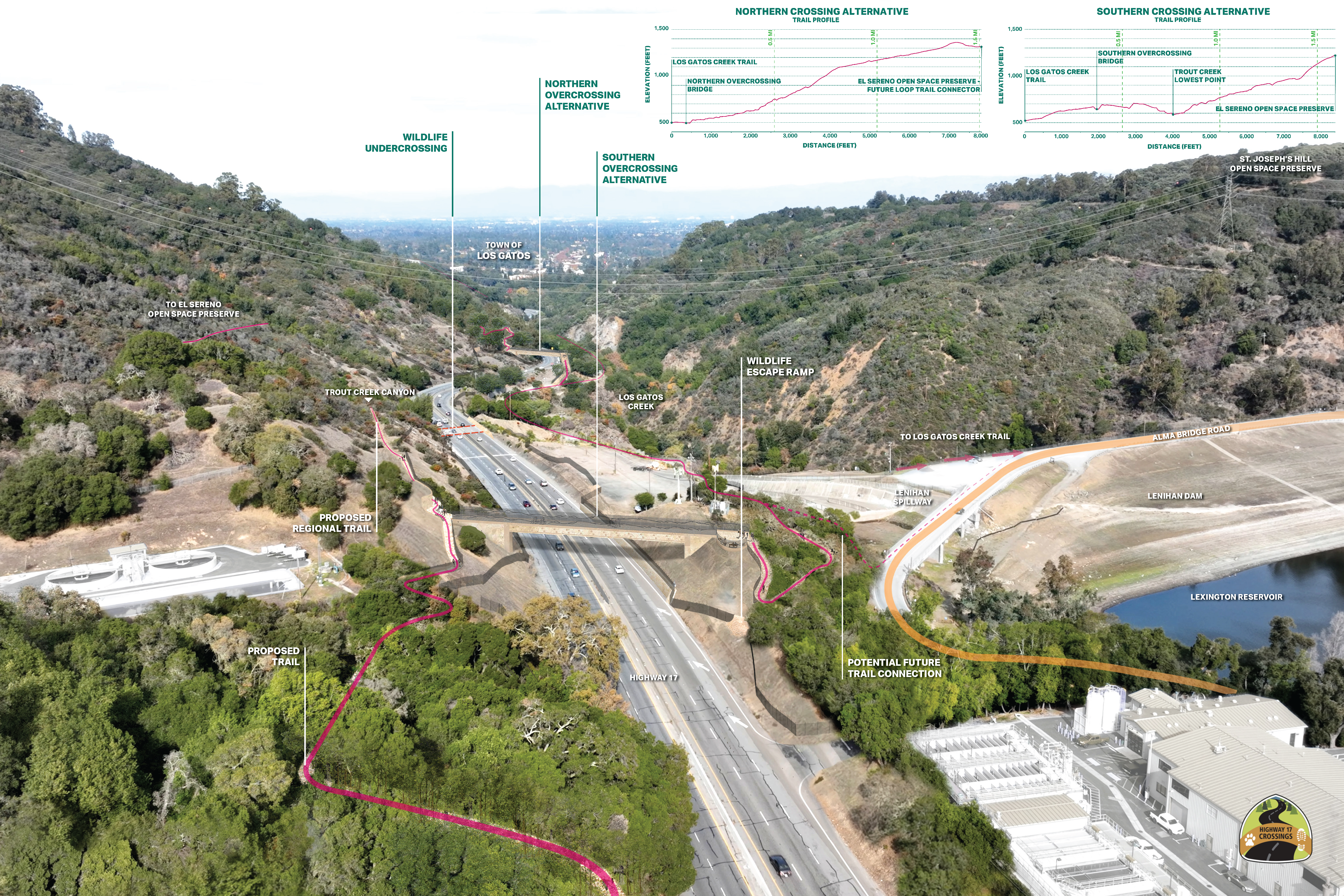
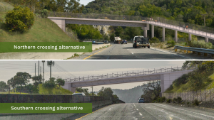
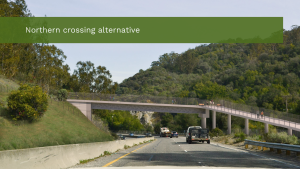
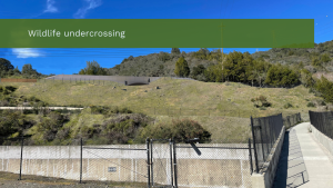
While wildlife and trail crossings share similar goals, animals and people have unique needs and use crossings in different ways. To meet the requirements of both, two distinct and separate structures have been recommended to cross Highway 17: a wildlife undercrossing and a trail overcrossing. The following locations for each crossing structure are currently under environmental review:
- a wildlife undercrossing at Trout Creek (2)
- a trail overcrossing either south of Trout Creek Canyon (southern overcrossing) or north of Trout Creek Canyon (northern overcrossing)

Project Renderings
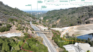
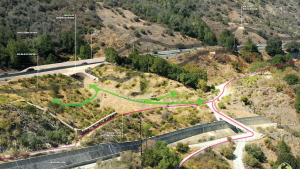

(These renderings are intended for illustrative purposes only and do not represent final design.
Project components, colors, materials, etc. will be finalized during the design phase.)
Project Updates and Related Stories
")
")


In March 2024, Midpen hosted a virtual community meeting to provide a status update on the Highway 17 Wildlife and Trail Crossings Project, discuss environmental assessment and provide opportunities for community members to ask questions and receive feedback. Watch a recording of the virtual meeting below:
Measure AA Funding
Additional Funding
As the project is currently estimated to cost approximately $40 million, Midpen is collaborating with many partners and stakeholders to fund this work, including Senator Jim Beall, who facilitated a $5 million grant from the California Wildlife Conservation Board, Senator Dave Cortese, who secured $2 million in the Budget Act of 2021, and the Gordon and Betty Moore Foundation, which awarded a $1 million grant to the project in November 2021.

Key Partners and Regional Stakeholders
This project requires a high level of coordination and partnership. Partners in this project may include:
California Wildlife Conservation Board
Bay Area Ridge Trail
California Department of Fish and Wildlife
California Department of Parks and Recreation
California State Coastal Conservancy
Caltrans District 4
Juan Bautista de Anza Trail (National Park Service)
Metropolitan Transportation Commission
National Wildlife Federation
The Nature Conservancy
Pathways for Wildlife
Peninsula Open Space Trust
Santa Clara County Parks
Santa Clara County Roads and Airports
Santa Clara Valley Transportation Authority : Project page
San Jose Water Company
Town of Los Gatos
UC Santa Cruz Puma Project
Valley Water
Midpen is continually developing additional partnerships and working with stakeholders to grow this list as the project develops.

Related Documents