Overview
Preserve Highlights & Features

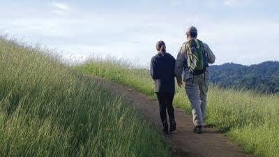
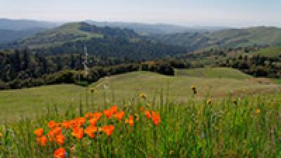
Views
Most of your walk or ride will be filled with terrific views of the valley, Lexington Reservoir and Sierra Azul and St. Joseph's Hill preserves.

Expanding Ridge Trail
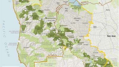
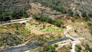
In the fall of 2020 and summer of 2021, Midpen partnered with the Peninsula Open Space Trust to expand El Sereno Preserve, one of the oldest in the agency's management portfolio. Funded by a grant from the California Wildlife Conservation Board, the purchase of 182 acres from the San Jose Water Company provided an important link in the preserve’s main trail and formally connected the 3.7-mile Aquinas Trail across the preserve. This advanced one of the priority action projects of the voter-supported Measure AA general obligation bond: the development of regional trail connections through El Sereno Preserve, which is also an important component of Midpen’s ongoing Highway 17 Wildlife and Regional Trail Crossings project. In October 2021, the Midpen board dedicated 3.5 miles of trail in El Sereno Preserve as part of the Bay Area Ridge Trail.

Senator Beall Commemorative Bench
On December 8, 2020, Midpen recognized state Sen. Jim Beall with a commemorative bench to honor his long-time dedication to the health of the open space lands of the Santa Cruz Mountains. Located on the Aquinas Trail, the bench faces south to overlook the lands surrounding Lexington Reservoir, with a view of San Jose to the east.

Dog Access
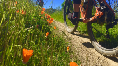
The landscape of Mount El Sereno is ideal for dog access. Dense brush and steep slopes help keep dogs within the trail corridor, which minimizes ecological disturbance, and the abundant chaparral plant communities have low sensitivity to any disturbance that might occur. During Midpen’s 18-month public visioning process that began in 2012, many El Sereno Preserve neighbors highlighted expanding dog access at the preserve as a priority for their community. After the board of directors approved the project to be included on the Five-Year Measure AA Project Prioritization List in 2014, Midpen staff held a number of public meetings and conducted a successful environmental review. The board opened the preserve to on-leash dog access in 2017.
Stories from the Preserves
")
")

Join our e-mail list to stay up-to-date on this preserve and other Midpen news!
Know Before You Go
Preserve regulations help provide a safe, enjoyable visit while protecting sensitive areas and wildlife.
El Sereno Preserve


Brochures and Resources
Some additional resources to help you enjoy the preserves!