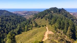
The Bay to Sea Trail is envisioned as an approximately 40-mile multiuse trail that will connect people from across the region to open space and create a link between the San Francisco Bay Trail and the California Coastal Trail along the Pacific Ocean.
Although the Bay to Sea Trail is just in the conceptual phase, our Ravenswood Open Space Preserve is envisioned as a key access point on the Bay side. Midpen's Purisima-to-the-Sea Trail, also in the conceptual phase, will likely be a key portion of the coastal side.
In 2020, Midpen joined 10 other public agencies, municipalities and private nonprofit organizations that manage and protect open space in the Bay Area to formalize an agreement to collaborate on creating the Bay to Sea Trail for public use by 2037.
Learn more about this project from our friends at Peninsula Regional Open Space Trust, who are working with Midpen in planning the Bay to Sea Trail’s route in coordination with a variety of dedicated partners who share this vision.