Midpen Preserve Maps
Midpen provides detailed maps for each of its publicly accessible open space preserves. These can be downloaded to a device, used in conjunction with a smartphone app or be printed on paper. These maps are also available at Midpen’s administrative office and posted in signboards at many Midpen trailheads. However, paper maps are not always available at the preserves so bring one with you before you leave home.
- Midpen Regional Map
- Bear Creek Redwoods
- Cloverdale Ranch
- Coal Creek
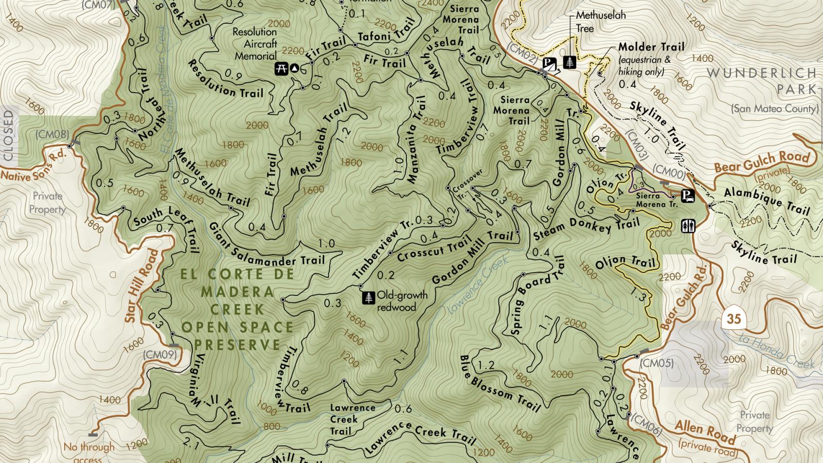
- El Corte de Madera Creek
- El Sereno
- Foothills
- Fremont Older
- La Honda Creek
- Long Ridge
- Los Trancos
- Monte Bello
- Picchetti Ranch
- Pulgas Ridge
- Purisima Creek Redwoods
- Rancho San Antonio
- Ravenswood
- Russian Ridge
- Saratoga Gap
- Sierra Azul
- Skyline Ridge
- St. Joseph's Hill
- Stevens Creek Shoreline Nature Area
- South Skyline Region
- Teague Hill
- Thornewood
- Windy Hill
Click here for instructions on printing a 17 x 22" map on 8.5 x 11" paper at home.
Navigate Offline
Use one of the free apps below to view your location on a Midpen preserve map and track your route using your device’s GPS signal even when you don’t have service. All of our maps are geo-coded to work with any GeoPDF reader if you have a different preferred app.
Avenza Maps
Avenza Maps allows you to view maps offline, see your location on the map, plot placemarkers and photo locations and measure distance. Midpen maps can be downloaded for free from within the Avenza Maps app or from the preserve pages on our website.
OuterSpatial
Access Midpen preserve maps and information in the palm of your hand with the OuterSpatial app. OuterSpatial provides access to some of Midpen’s self-guided hikes, including the Ravenswood Bay Trail and San Andreas Fault Trail guides. Also, find maps and info from many other park agencies in our region and beyond.
See all of your Midpen map options at openspace.org/maps.