Midpen is creating a comprehensive plan to responsibly guide public access, restoration and land management at Purisima Creek Redwoods Open Space Preserve.
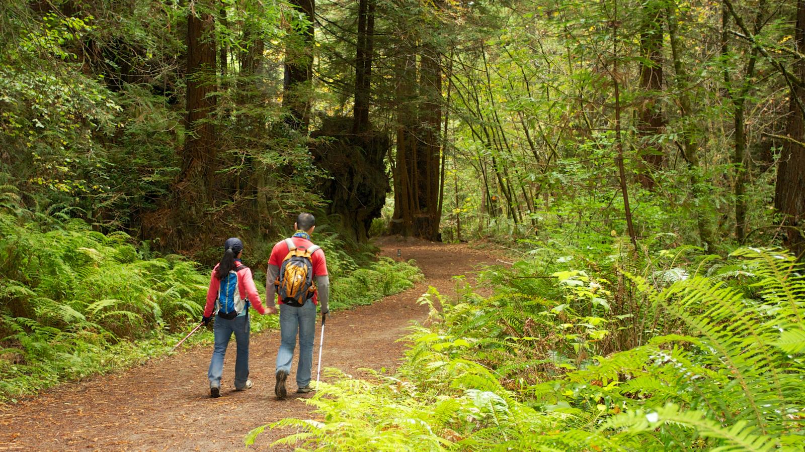
The Comprehensive Use and Management Plan brings together new public access projects, environmental restoration projects, wildfire resiliency, agricultural uses, and other ongoing land management uses into a unified, long-term vision for this preserve. These new and ongoing projects are designed to serve both people and ecosystems at this popular preserve.
Under the Comprehensive Plan, four new projects are proposed that would provide enhanced public access and recreation opportunities within the preserve.
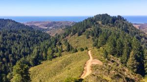
- Construction of the new Purisima-to-the-Sea Trail
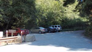
- Construction of the new Verde Road parking area that will serve as an access point to the Purisima-to-the-Sea Trail
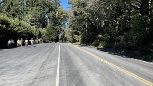
- Expansion of the existing North Ridge Parking Area and the creation of a connection to the Bay Area Ridge Trail
- Implementation of multimodal access and transportation demand management strategies
In conjunction with the new public access projects, the Irish Ridge Restoration Plan will aim to improve the ecosystem in a section of the preserve that has been degraded by the presence of invasive species. Restoration of this section of the preserve will help enhance wildland fire resiliency in the future.
This comprehensive plan brings together years’ worth of technical studies, resource analysis, community feedback and regional collaboration with partners. The community and partners will continue to have multiple opportunities for feedback and participation in the process of creating the comprehensive plan.
Public Meeting: Midpen Board of Directors
Wednesday, October 22, 2025 at 7 p.m.
In-person at 5050 El Camino Real, Los Altos, CA and via Zoom.
At this meeting, Midpen’s board will receive an overview of the Purisima Creek Redwoods Comprehensive Use and Management Plan components from staff, provide feedback, hear public comment and consider the plan components as the project description to initiate the required CEQA environmental review.


Goals and Objectives
The Comprehensive Use and Management Plan establishes a long-term, integrated vision that balances Midpen’s braided mission of resource protection, the preservation of agricultural land and ecologically sensitive public access at this preserve.
Goals for this project include:
- Guide the long-term land management, operations and public access actions and activities in balance with protecting and enhancing natural resources and sustaining existing agricultural uses on the San Mateo County Coastside.
- Consolidate new and existing uses, programs, and operations at the Preserve into a single planning document that provides a cohesive approach for implementing ongoing actions with proposed improvements.
- Streamline the planning and environmental review process for several projects taking place in Purisima Creek Redwoods by creating a single, comprehensive plan for the preserve.
- Creating new trail alignments in support of regional trail connections, such as the Bay Area Ridge Trail, California Coastal Trail, Purisima-to-the-Sea Trail, and future proposed Bay to Sea Trail.
- Providing new and expanded parking areas at this beloved preserve, where parking demand often exceeds availability during peak visitation hours.
- Improving sections of the preserve that have been degraded by invasive species by enabling large-scale restoration projects to take place.
- Providing an outline to guide wildfire resiliency projects at this large preserve.
Stay informed!
Frequently Asked Questions
Each new public access project, including Purisima-to-the-Sea Trail, Verde Road Parking, Hwy 35 Multiuse Crossing and Parking Expansion, and Purisima Multimodal Access Implementation, had a separate, robust public engagement process as part of the feasibility study to receive public and Board feedback. More than fifty public engagement events were held both virtually and in person from 2020-2025 and feedback has been incorporated into the Board-affirmed conceptual designs. Links to the completed feasibility studies are provided at the top of this webpage and the results from those studies will also be discussed in the full draft CUMP.
The public can visit this project webpage (www.openspace.org/PCR-Plan) for project updates, including project status, next steps, and upcoming meetings, and to sign up for the Purisima interested parties list to receive email notifications. There will be opportunities for public review and comment on the full draft CUMP and CEQA document, anticipated in Spring 2026.
Midpen will continue to coordinate with our partners to provide and promote clear information to the public about external regional trail alignments and facilities. This regional partner coordination will be an ongoing effort with the goal of providing timely updates prior to the public opening of these new regional trails/connections. Information on the regional SFPUC Ridge Trail Extension, Bay to Sea Trail, and the California Coastal Trail is currently available through each organizations' websites and on this project website.
The Plan includes priorities to evaluate potential dog access at the Preserve as well as potential opportunities for additional loop trails. Additional evaluations to study dog access and new loop trails at the Preserve would require staff to present the results of those studies and proposed recommendations to the Board for their consideration and approval regarding specific implementation. The evaluation for dog access will incorporate the 1995 Board-adopted Dog Access Site Suitability Criteria. The Plan also includes redesignating a portion of the Irish Ridge Trail from hiking only to multi-use to connect to the future Purisima-to-the-Sea trail. The Plan does not include e-bike use at the Preserve unless it is used as an ADA other powered mobility device.
Yes, trails will be designed and constructed in accordance with Midpen's Trail Use Policy, Coastal Service Plan policies and guidelines, and Trail Details and Specifications Guidelines.
The pilot shuttle program is expected to be initiated when the Verde parking area is open to the public. However, should one of these elements (trail, parking area, or shuttle) be delayed during permitting or construction, staff will consider other options to open some components earlier than others to expedite the new public access improvements to the Preserve on the Coastside.
The pilot shuttle program was presented in the Purisima Multimodal implementation report accepted by the Board on December 11, 2024. A link to the Board report and shuttle program details is available at the top of the CUMP webpage (www.openspace.org/PCR-Plan). The pilot program will be developed using recommendations from this report as well as expertise from a future shuttle operator/vendor. Midpen will also utilize adaptive management strategies to address any potential challenges during implementation.
Each action is assigned a phase (I, II, III) and priority (high/medium/low). Phasing for each action has been assigned based on project timelines, staff availability, partner coordination and necessary project sequencing. Actions are prioritized based on Board and public priorities, staff input, as well as whether other ongoing or previous projects have separately addressed the purpose of a particular action.
The North Ridge parking expansion project will add more parking within the expanded lot and remove most of the roadside parking along Hwy 35 adjacent to the lot. The expanded and reconfigured parking area will improve circulation and provide safer parking options by relocating a majority of parking onsite. Midpen does not anticipate that this will completely meet demand for parking during peak visitation. Additional transportation demand management strategies (TDMs), such as real-time parking information, are also proposed at the North Ridge parking area to help visitors plan ahead and avoid congestion during peak visitation times. Midpen will continue to coordinate with responsible agencies to ensure enforcement of areas near preserve parking areas that are designated as “no parking” zones.
The following multimodal amenities will be implemented at the parking areas/trailheads as part of either an ongoing effort or one of the new parking area projects:
- Purisima Creek: Bicycle tire cleaning station, bicycle repair station, bike rack, and boot brush
- North Ridge: Real-time parking information (online only), bicycle tire cleaning station, bicycle repair station, bike rack, and boot brush
- Verde: Pilot shuttle program service, real-time parking information (online only), bicycle tire cleaning station, bicycle repair station, bike rack, and boot brush
- Redwood: Bike rack
The Hwy 35 and Purisima-to-the-Sea feasibility studies and subsequent design phases included traffic studies that determined appropriate pedestrian crossing locations on the highways and Verde Road. The crossing improvements were designed based on existing site conditions, including observed speeds, to meet Caltrans required standards. Caltrans approvals are required for Midpen to implement the Hwy 35 and Hwy 1 crossings. During the permit application process, Caltrans will determine the necessary requirements and revisions to the crossing design to receive final approval. For more information about the feasibility studies, including technical studies, public engagement and conceptual designs, visit the project websites linked at the top of this project webpage.
Midpen will continue to coordinate with law enforcement and Caltrans regarding vehicle speed and parking concerns along Skyline Boulevard. These agencies are aware of these concerns along Skyline Boulevard. Midpen rangers currently enforce parking regulations in and around Midpen parking areas.
In addition to the questions on this FAQ list, public feedback has also included the following:
Concerns about speeding on nearby roadways and pedestrian safety on highway crossings.
- Response: Midpen will continue to coordinate with law enforcement and Caltrans regarding safety concerns along Skyline Boulevard.
Concerns about addressing parking demand and issues with shoulder parking along Hwy 35 (Skyline Boulevard);
- Response: While the North Ridge parking expansion project will add more parking within the expanded lot and remove most of the roadside parking along Hwy 35 adjacent to the lot, Midpen does not anticipate that this will completely meet demand for parking during peak visitation. Additional transportation demand management strategies (TDMs), such as real-time parking information, are also proposed at the North Ridge parking area to help visitors plan ahead and avoid congestion during peak visitation times. The expanded and reconfigured parking area will improve circulation and provide safer parking options by relocating a majority of parking onsite. Midpen will also enforce nearby areas that are designated as “no parking” zones.
Need for fire prevention and concerns about fire from a backpack camp.
- Response: A recommended action in the CUMP includes evaluating regional trail amenities and facilities (including backpack camps) and future studies will provide more information on what may be feasible. The public will have additional opportunities to provide input on this and other regional trail amenities and facilities prior to any decisions being made about implementation.
Interest in providing dog access and more loop trails at Purisima.
- Response: A recommended action in the CUMP includes evaluating dog use and more loop trails at Purisima and future studies will provide more information on what may be feasible. The public will have additional opportunities to provide input on this and other regional trail amenities and facilities prior to any decisions being made about implementation.
Concerns about public access impacts in areas with active grazing and/or sensitive natural resources.
- Response: The actions included in the CUMP implementation action table have been developed to emphasize Midpen’s priorities for protecting natural resources and supporting conservation grazing operations when considering new and ongoing public access. The full draft CUMP will also include information about existing resources and goals for protecting natural resources and grazing operations.
Interest in highlighting the local history of the Preserve.
- Response: The CUMP implementation action table includes actions related to providing more interpretive elements at the Preserve, including topics such as local agriculture and oil refinery history. The table also identifies potential partners including San Mateo County Historical Society, Half Moon Bay History Association, and the Coastside Land Trust. The full draft CUMP will also discuss any known historic resources within the Preserve.
Interest in the future pilot shuttle program and request for clear communication with the public when it opens.
- Response: More information on the shuttle program and parking management strategies implementation can be found on the project website.
Midpen has heard concerns related to traffic safety and parking congestion that are being addressed both through ongoing coordination with law enforcement, parking enforcement by Midpen rangers and through the design process for new public access projects. The CUMP includes the new Verde Road parking area and expanded North Ridge parking area projects that will add more onsite parking to serve preserve visitors while reducing roadside parking in areas near these parking areas. In addition, both of these parking area projects will include transportation-demand management strategies to help address parking demand and reduce congestion. Real-time parking information will be provided online for both parking areas that will help visitors plan ahead and avoid congestion during peak visitation times. The Verde Road parking area will also incorporate a pilot shuttle program to provide access to the Purisima Creek trailhead and reduce parking and traffic congestion at the trailhead while the shuttle is operating. Midpen rangers currently enforce parking regulations in and around Midpen parking areas.
The Verde Road and North Ridge parking area designs also include multi-use highway crossings. Traffic studies were conducted during the projects' feasibility phase that determined appropriate pedestrian crossing locations on Highway 35, Highway 1 and Verde Road. The crossing improvements were designed based on existing site conditions, including observed speeds, to meet Caltrans required standards. Caltrans approvals are required for Midpen to implement the Highway 35 and Highway 1 crossings. During the permit application process, Caltrans will determine the necessary requirements and revisions to the crossing design to receive final approval. Midpen will continue to coordinate with law enforcement and Caltrans regarding vehicle speed and parking concerns along Highway 35/Skyline Boulevard. These agencies are aware of these concerns along Highway 35/Skyline Boulevard.
Timeline
2004 | Midpen boundaries expand to include the San Mateo County Coast after a vote by residents. |
2004-2020 | Midpen works in a public-private partnership with POST, preserving a corridor of open space from Purisima Creek Redwoods to the coast. |
2020-2025 | Design development, public outreach and stakeholder engagement for the various projects included under the Comprehensive Use and Management Plan. |
August 26, 2025 | Public Committee Meeting: Review plan elements with Midpen's Planning and Natural Resources Committee, which will consider forwarding the plan elements to the full Board of Directors for further review. |
Fall 2025 | Public Board Meeting: Review plan elements with full Midpen Board of Directors, which will consider initiating CEQA environmental review. |
Fall 2025 | Staff will continue to refine the plan based on feedback from the Board and the public. |
Spring 2026 | Public comment periods open for environmental review and Comprehensive Use and Management Plan. |
Summer 2026 | Public Board meeting to consider certification of the CEQA environmental review document and approval of the Comprehensive Use and Management Plan. |

Funding
Purisima-to-the-Sea Trail and Parking Area Funding Partners
The California Coastal Conservancy awarded Midpen a $300,000 grant to fund initial feasibility studies for the Purisima-to-the-Sea Trail and Verde Road parking lot in 2021. Future grants to support the project will be sought.

Bay Area Ridge Trail Connection and Parking Area Expansion Funding Partners
Funding for the Bay Area Ridge Trail Connection and Parking Area Expansion feasibility study was provided by a $114,000 grant from the San Francisco Public Utilities Commission, $50,000 from the Peninsula Open Space Trust (POST) and a $14,000 contribution from Bay Area Ridge Trail.
Related Projects


