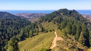
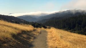
Midpen is planning improvements to public access and regional trail connections at Purisima Creek Redwoods Open Space Preserve. The Highway 35 Multi-use Crossing and Parking Expansion Project aims to improve public access facilities at the North Ridge Parking Area and establish a connection between the preserve and the new San Francisco Public Utilities Commission (SFPUC) extension of the Bay Area Ridge Trail on the east side of Highway 35 (Skyline Watershed Ridge Trail). The crossing will also provide a connection to the planned Purisima-to-the-Sea trail, which will allow visitors to hike from the ridgeline down to a planned connection with the Cowell-Purisima Trail, a section of the California Coastal Trail.
The project is currently undergoing CEQA environmental review as part of the Purisima Comprehensive Use and Management Plan, which is expected to continue through early 2027. Construction is expected to begin in 2027.


Project Details:
Beginning in 2021, Midpen partnered with SFPUC, Bay Area Ridge Trail Council, and POST to explore a spur trail and highway crossing that would connect the southern end of the Skyline Watershed Ridge Trail to Midpen’s North Ridge Trailhead at Purisima Creek Redwoods. Midpen received grant funding from these organizations for the Highway 35 Multi-use Crossing and Parking Expansion feasibility study.
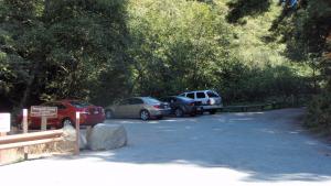
The North Ridge Parking Area is planned to be reconfigured and expanded The expanded parking area would provide up to 70 standard vehicle spaces, two designated equestrian trailer parking spaces and three roadside parking spaces. The parking area would be paved and striped to improve circulation and ease of maintenance. An onsite stormwater treatment and bioretention area will also be added near the parking area.
The project would also improve accessibility at the trailhead. An ADA-accessible path of travel would connect the highway crossing to the North Ridge Trailhead and the ADA-accessible parking area would provide additional amenities, such as updated signage at the trailhead, bicycle parking and repair facilities and a new ADA-accessible vault toilet. Together, these improvements would provide better access for visitors arriving by vehicle, bicycle, foot or horse trailer, while improving the overall visitor experience.
The project supports a larger vision for connecting open spaces and trails across the region. By linking Purisima Creek Redwoods to the new Skyline Watershed Ridge Trail segment, the project will extend the regional trail network and provide visitors with additional ways to explore the landscape.
Goals and Objectives:
A feasibility study for this project, completed in 2023, developed the following project goals and strategies to guide the design development.
Goal 1: Support the implementation of the regional Bay Area Ridge Trail.
- Identify a multi-use trail crossing and trail spur location to connect the SFPUC’s new segment of the Bay Area Ridge Trail to the Preserve and the existing Bay Area Ridge Trail segment within the Preserve.
- Maximize safety and minimize neighbor impacts when evaluating multi-use trail crossing locations and infrastructure.
- Develop a multi-use trail crossing and spur trail to accommodate low-intensity recreational use by hikers, bicyclists and equestrians, consistent with Bay Area Ridge Trail corridor goals.
- Collaborate with partner agencies to complete the planning, design, and implementation of the multi-use trail crossing and spur trail.
Goal 2: Improve public access and visitor experience at Purisima’s North Ridge trailhead using ecologically sensitive design, construction practices, and long-term maintenance and management.
- Strategies:
- Add parking capacity through the reconfiguration of existing parking spaces and expansion of the North Ridge Parking Area.
- Improve the existing trailhead amenities, such as replacing the existing restroom with a new Americans with Disabilities Act (ADA) compliant vault restroom, replacing dated signboards with current standard design, and adding bicycle parking.
- Incorporate transportation demand management strategies consistent with the Board-approved Purisima Multimodal Access Study.
- Design recreational amenities to protect the scenic corridor.
- Maximize safety and minimize neighbor impacts when evaluating the multi-use trail crossing, parking enhancements, and vehicle circulation.
- Maintain routine patrols and maintenance and use adaptive management to address unforeseen issues that arise from increased visitation to the North Ridge Trailhead.
Stay informed!
Timeline
| 2021-2022 | Biological, cultural, topographic and traffic studies. |
| Fall 2022-Spring 2023 | Focused public outreach and stakeholder engagement. |
| Spring 2023 | Geotechnical analysis and cost estimates. |
| April 4, 2023 | Public meeting with Midpen's Planning and Natural Resources Committee to review results, hear public comment and provide recommendations. (agenda and minutes) |
| June 7, 2023 | Virtual public workshop to share preliminary parking concepts for the expansion and reconfiguration of the Purisima North Ridge parking area and receive public feedback. |
| July 25, 2023 | Public meeting with Midpen's Planning and Natural Resources Committee to hear public comment, and review and consider recommending to full board for approval. (agenda and minutes) |
| Nov. 8, 2023 | Public meeting with Midpen's full board of directors to hear public comment and consider approving the study and recommendations. (agenda and minutes) |
| 2024-2026 | CEQA Environmental review as part of the Purisima Comprehensive Use and Management Plan |
| 2027 | Permitting |
| 2027-2028 | Construction |

Funding
Additional Funding
The Feasibility Study is expected to cost $189,000. Funding for this study is provided by a $114,000 grant from the San Francisco Public Utilities Commission, $50,000 from the Peninsula Open Space Trust (POST) and a $14,000 contribution from Bay Area Ridge Trail.

Documents and Reports
Related Projects